
Sugar River Rail Trail
With springtime mud season beginning in the middle Connecticut River Valley, this is generally the time of the year when higher elevation trails are neglected temporarily, giving them a chance to shed their snow and slush - offering the trail system a chance to dry out before resuming the lofty climbs. Conveniently for most hikers, bikers, skiers, snowshoers, and recreationists of the northeast, there is a vast network of old, retired railroad bed corridors to temporarily satiate any woods travel, albeit without strenuous climbing - this, for me, is a prime opportunity to rebuild some endurance in the leg muscles after the slow, tedious art of snowshoe bushwhacking all winter.

Early along the Sugar River Rail Trail
Maps of local, repurposed rail corridors can be readily found these days by doing a simple search online, there are even several books published on the subject as well. For those looking for a different type of hiking challenge - one which is perfect for springtime mud season - is the New Hampshire Rail Trail Challenge, sponsored and overseen by the New Hampshire Rail Trail Coalition (a link to their informative website can be found: here). The challenge has very loose rules (just explore the rail trails by any approved mode of travel! Applicants are encouraged to stay within their comfort and conditioning zones while recreating these trails, as well), which makes trekking some of the longer trails a bit more obtainable for those on foot, such as myself.
Most rail trails are repurposed and maintained by local snowmobile clubs for their winter recreational uses; many of these official rail trail corridors, however, are also beautifully maintained by the Trails Bureau of the New Hampshire Parks & Recreation division. This team of trail builders oversees many multi-use recreation trails across the state on both public and private land - it was reassuring to see them out clearing small blowdowns and debris from the Sugar River trail bridges along this venture.
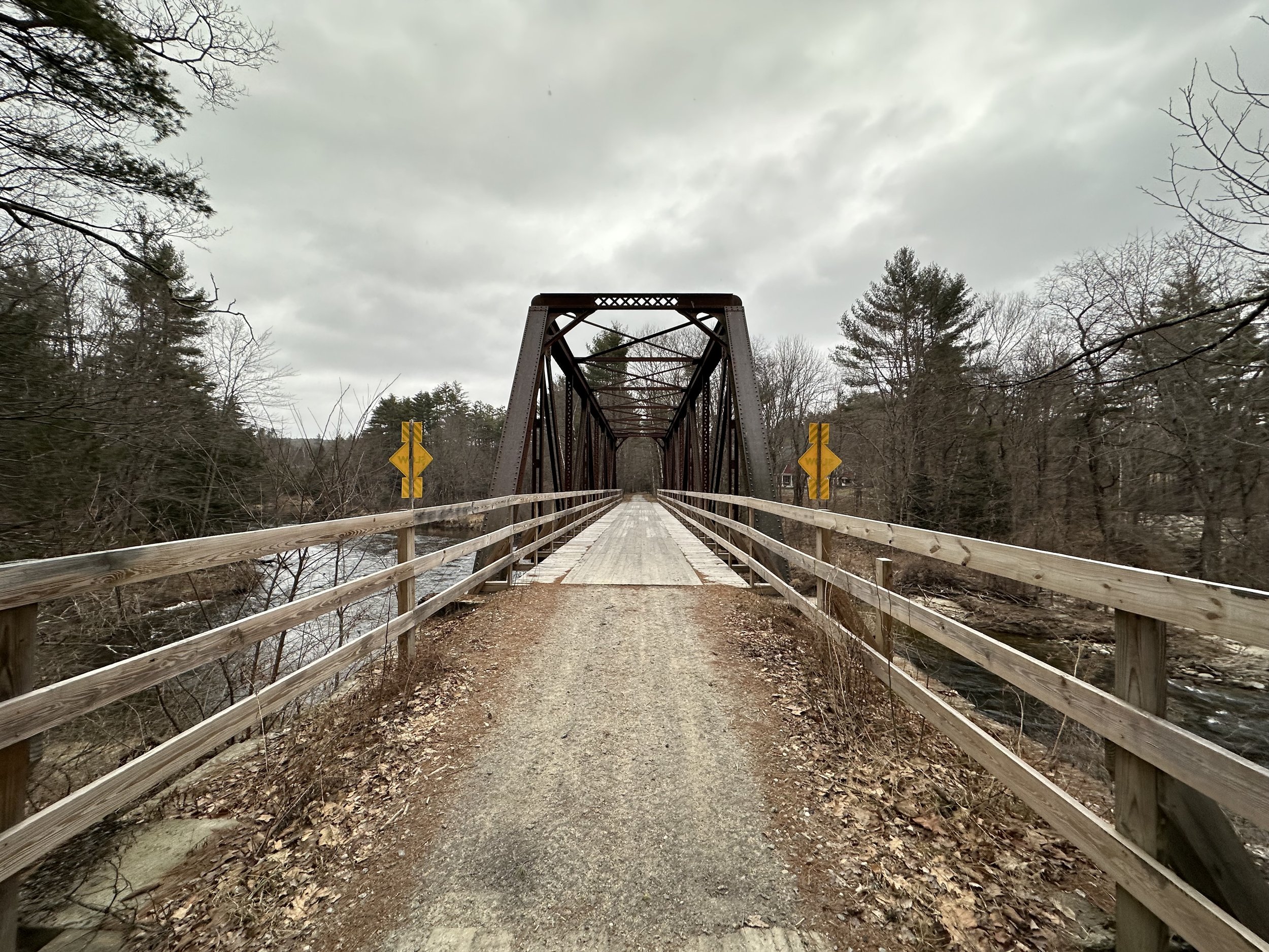
One of many steel bridges along the old RR corridor
For various reasons, I chose to begin my trail run stroll from Newport, NH; from the eastern terminus of the rail trail. Here, visitors can find a large parking area which only has signage indicating to not park within a certain distance from nearby propane tanks - there is a large wooden welcome sign which I saw upon my departure, as my GPS brought me to the trailhead from the southwest, therefore missing all trailhead signage - which made the parking situation seem more-or-less as a free for all at this terminus.

Sugar River alongside the Sugar River Rail Trail
Footing along this entire rail trail corridor was overall soft and sturdy, most of the trail bed composed of compacted sand, gravel, and crushed stone. For the first 1.5-miles, this stretch of railbed meanders in a relatively straight course along the Sugar River, making the first of seven water crossings atop an old steel truss bridge. This stretch of railroad was originally built by the Sugar River Railroad for the Concord and Claremont Railroad; similar to many short line railroads of New Hampshire at the time, this corridor was soon acquired by the Boston & Maine Railroad, who then renamed the line to their Claremont Branch.
Exiting the town and leaving several residential buildings behind, the trail soon passes several small vernal pools before entering a near-straight length of trail with many massive white pine trees to the west (left while heading north); these soon give way to a shaded knoll of stunning hemlock. There is, unfortunately, one unsightly, clear cut logged patch which will hopefully be fixed up soon, to enhance the visitors experience; to the east, the mighty Sugar River babbles away.

Pier Covered Bridge
As the Sugar River rail trail begins a long sweep west/southwesterly around the hilly landmass of northern Newport, several open-deck steel bridges aid in crossing the Sugar River. Any of these bridges make for a great place to disembark from the path momentarily and find a reprieve - to listen to the rushing water and watch for elusive wildlife. With the trail bed consisting of compacted sand and crushed stone primarily, there are several small sections which may have been filled-in following heavy rains or snow melt - bikers may want to exude a bit of caution through any of these localized sandy patches. Overall, the surface of the trail was fantastic for foot travel - grippy, yet much more forgiving on the joints than asphalt.
Along the course of the Sugar River rail trail, there are many side spur trails which whisk visitors southward to either the water’s edge, or conversely, into the forest and toward various other points north. Trailside, remnants of old railroad ties can be found as nature works to reclaim the timber, several remaining granite mile marker posts can also be spotted along the route, as well as a collapsed railroad siding of some sort.

Entering Chandler’s Mills (rail trail: left/road: right)
Meandering through the Sugar River Valley, the trail crosses the Sugar River once again on a high, steel truss bridge before intersecting Oak Street, southeast of this crossing, the dilapidated and highly spray-painted remains of a run-down mill can be found riverside - its red brick walls and matching smoke stack taking me right back to the old chocolate factory of my hometown - what a sight!
As the Sugar River flows beside the path to the east, the rail trail soon enters a stretch which follows the river grade, with a high embankment on the opposite side; the hillside features many small drainages, none of which impacted the trail at all, footing remained dry and pleasant. Watching the river split, just to merge once again further downstream was an interesting way of passing some of the quiet miles this morning, along this stretch.

Parks & Rec: Trails Bureau - spring cleaning in Wrights Bridge
Another trailhead parking area can be found as recreationists enter Kelleyville, passing beneath the steel girders of the NH Route 103 overpass. Following the course of the Sugar River, the trail now passes a cleared field area with a residence high atop a distant hill - what a view they must find from such lofty heights! Reentering the woods briefly, soon, the looming, wooden structure of the Pier covered bridge comes into sight. Named for its center pier mid-river, the Pier Bridge was built by the Boston & Maine railroad in 1907, during a period when the railroad was refurbishing and rebuilding many of their open bridged crossings with covered bridges - covered as to protect their intricate, wooden truss systems from weather and harsh elements.
Trailside historical placards await visitors who crave just a bit more information about the old railroad structures. Continuing west, the footway begins to transition to more of a cinder quality, and overall, less sandy for the remaining distance - if memory serves me correctly - I recall no issues with loose, sandy, nor wet footing until arriving in Claremont, NH.

Nearing the western end of the Sugar River Rail Trail
Today, the town was re-grading their roads following several weeks of spring thaw, which would normally not be an issue, but arriving in the town of Chandler’s Mills, the rail trail corridor promptly crosses Chandler’s Mill Road, which was a bit choppy this morning due to roadwork. As the rail trail traces alongside the earthen roadway, its surface became wet (icy in the 36° morning air), coarse grained and rather loose - bicyclists may find a more pleasurable ride directly along the shoulder of the dirt road, while obviously watching for occasional vehicular traffic.
As Chandler’s Mill Road veers southwesterly, the Sugar River rail trail continues straight ahead; before long Wrights Bridge comes into view, the second covered bridge along this river route. While not quite as lengthy a span as Pier Bridge, this bridge was receiving a good cleaning from the New Hampshire Trails Bureau as I passed. This covered bridge was built by the B&M railroad in 1906, another similar trailside information kiosk can be found which describes its technology, the parent railroad, and its engineer/builder.

The Bobby Woodman Rail Trail through the commercial district
Beyond Wrights Bridge, the trail enters a long, boggy corridor of restricted Conservation area. Footing remained favorable along this stretch of low land, although there were several small, loose and sandy sections which had likely flooded during recent rainstorms combined with an early spring thaw. Evidenced by the scent of fresh cut lumber, the Trails Bureau had been through here earlier in their work morning, cutting and removing several toppled trees from the trail corridor.
As the rail trail continues along the Sugar River, businesses and various residences begin to appear to the north. Unfortunately, it seems landowners and business owners (as well as highway motorists) just throw cardboard and trash right off their back steps - this hillside was littered with trash and debris of various bright colors - that was hard to ignore given the stunning vista to the south: the Sugar River spilling out to pastures and fields, with low mounds of mountains rising in the near distance.

Following the old rail corridor away from Washington Street
Along the old railroad corridor, it became a fun game to spot the old (now relatively brushed in) railroad sidings, Y’s, and various other junctions along its course through the Sugar River Valley. As the sun began to shine through the clouds, I reached a main trailhead parking lot (adequate parking space for snowmobile trailers or horse trailers) on US Route 103, just east of Claremont.
While this stretch of repurposed rail bed alone would have made for a hefty mileage day, I also wanted to pay a visit to the Bobby Woodman rail trail corridor - which is essentially a continuation of the Sugar River rail trail from the very parking lot whence I stood. As the old corridor was obvious in its westward course, I followed the trail as it became narrow, sandy, and grassy.

Back on the Sugar River Rail Trail
Before long, the Bobby Woodman (named for Robert Woodman, active in city govt, and member of Conservation Commission) corridor begins to trace Washington Street, a busy shopping thoroughfare, complete with asphalt road crossings, stop lights to monitor and traffic seemingly coming from all directions. While not my favorite length of trail, it certainly was a unique way of seeing this commercial area - in looking at old topographic maps of this region, it seems there was an old drive-in theater near where the Home Depot plaza now resides; how interesting to imagine how life would have been back then, without big box stores on every corner.
Upon passing the International truck dealer and repair shop, the rail trail diverges from Washington Street and dives back under the shaded canopy of several stately oak trees. As this stretch of rail trail crosses the Sugar River yet again on a steel truss bridge, I met a very nice couple who were enjoying their morning while giving back to the community by hauling stale beer cans out of the adjacent woods. For several minutes, we talked on my return passing and thanked them for the hard work; where the couple had already cleaned was very obvious - many warm regards to Barbara and Terry!

One of many steel truss bridges along the old railroad corridor
This adventure of the Bobby Woodman rail trail ended about a quarter mile beyond the couple hard at work; cruising around a corner behind several residential houses, I saw a shadowy feature slumped over on the side of the trail. Knowing there are several iffy sections of Claremont, I grew content with my morning thus far and chose to begin my return westbound, to Newport - after all, the Rail Trail Challenge simply states that a trail must simply be “explored”; I think I fully satisfied that check box.
While I would like to venture further into Claremont, to search for remnants of the old, electrified portion of the Concord + Claremont Railroad, which appears to have been in service until the late-1980’s.

Nearing Newport, the trail passes through a cool grove of hemlock
For those wishing to embark on a trek of either rail trail - I would strongly recommend visiting any trailhead along the Sugar River trail. While the Bobby Woodman route is certainly unique, and interesting, it essentially just follows a commercial district and many store fronts with stop lights to contend with. Much more litter and trash was found along the Claremont stretch of this multi-use path, no doubt detracting from the overall enjoyment and relative feeling of safety along this corridor.
As with any city these days, Claremont certainly has places I would avoid when alone or traveling at night; but there are also many gorgeous areas of Claremont as well. Complete with elegant, historical structures and towering, old infrastructure - a rail trail is certainly a fantastic and alternative way to visit some of these more obscure places where only steel rails ventured. It may be fast approaching 50 years since these corridors echoed the haunting bellowing of a steam locomotive whistle, but exploring their rocky cuts and old, wooden bridges can make anyone want to don their Conductor cap for the day.
Overall stats for the day:
21.68-miles
3hr 53 minutes
466’ elevation gain
Sugar River Rail Trail - 9.2-miles, 1-way
Bobby Woodman Rail Trail - 2.2-miles, 1-way

Good day on the trails!